
What Is The Difference Between High And Low Pressure?
Low pressure means air near the ground converges and rises, cooling into clouds, rain and stronger winds. High pressure means air sinks, warms and dries, which usually brings clear skies and lighter winds. In the Northern Hemisphere, winds circle lows counterclockwise and highs clockwise. Troughs and ridges are stretched-out versions of lows and highs.
The big red L and blue H on the evening forecast are not decoration. They are the two main characters of almost every weather story. Learn what each one does to the air above you, and you can guess the weekend before anyone tells you.
Key Takeaways
- Lows have converging, rising air and tend to bring clouds, precipitation and wind.
- Highs have sinking, drying air and tend to bring clear skies and light wind.
- Northern Hemisphere winds circle lows counterclockwise and highs clockwise.
- Troughs are elongated low pressure and ridges are elongated high pressure.
- On a surface map, tight isobars mean strong wind and fronts usually extend from lows.
Open any weather map and you will see big letters: a blue H and a red L. Those pressure centers, and the troughs and ridges stretching between them, are the basic building blocks of weather. Learn to read them and you can tell at a glance where it is likely to be stormy and where it is likely to be calm.
What Does Low Pressure Mean For Weather?
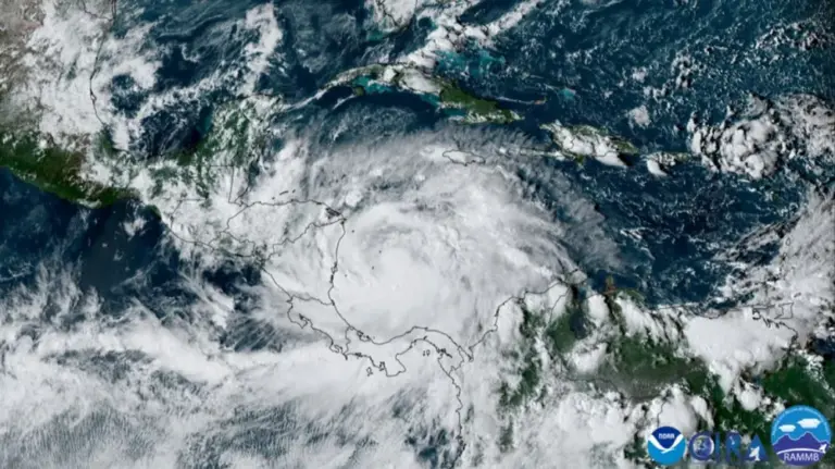
A Low Pressure center (L) is a spot where sea-level pressure is lower than all around it. In the Northern Hemisphere, surface winds circle a low counterclockwise and spiral inward, a pattern called a cyclone. (Meteorologists use "cyclone" for any low, not only hurricanes.)
Because air converges into a low near the ground, it has to go somewhere, so it rises. Rising air expands and cools, water vapor condenses, and clouds and precipitation form. That is why lows are associated with:
- Clouds, rain or snow
- Stronger winds
- Fronts, which usually extend from the low's center
- Changeable, often stormy weather
Midlatitude lows are typically 1,000-2,500 km across and last several days as they travel west to east.
What Does High Pressure Mean For Weather?
A High Pressure center (H) is a spot where pressure is higher than all around it. Northern Hemisphere surface winds circle a high clockwise and spiral outward, a pattern called an anticyclone. Air diverging near the surface is replaced by air sinking from above. Sinking air warms by compression and dries out, which evaporates clouds.
Highs usually bring:
- Clear or mostly clear skies
- Light winds, especially near the center
- Cool nights and large daily temperature swings
- In winter, bitter cold under arctic highs; in summer, heat waves under stationary highs
What Is A Trough And A Ridge In Weather?
Pressure patterns are not just circles. They stretch into elongated shapes:
- A Trough is an elongated area of relatively low pressure, extending out from a low. Isobars bend into a U or V shape. Troughs often carry fronts, wind shifts and bands of clouds and showers. On maps they may be drawn as a dashed brown or orange line.
- A Ridge is an elongated area of relatively high pressure, extending out from a high. Isobars bulge outward in an upside-down U. Ridges bring generally fair weather.
Troughs and ridges are even more important in the upper atmosphere, where the flow forms a wavy pattern around the globe. Upper troughs support rising air and storm development downstream; upper ridges support sinking air and warm, quiet weather. The next lesson explores this upper-level pattern.
How Do You Read A Weather Map?
A Surface Analysis is a map of sea-level pressure, fronts and station observations drawn by forecasters every few hours. Here is how to read one:
- Find the H and L centers. The number printed beside each is its central pressure in millibars, such as 1032 for a strong high or 988 for a deep low.
- Follow the isobars. They are drawn every 4 mb (1000, 1004, 1008 and so on). Isobars never cross.
- Check the spacing. Where isobars are tight, expect strong wind. Where they are spread apart, expect light wind.
- Picture the wind. Air circulates counterclockwise around lows and clockwise around highs (Northern Hemisphere), crossing the isobars slightly toward low pressure.
- Locate the fronts. Blue lines with triangles are cold fronts; red lines with half circles are warm fronts. They usually radiate from lows and mark where the weather changes most sharply.
- Read the station plots. Each dot shows temperature, dew point, wind direction and speed, cloud cover and pressure.
How Highs And Lows Interact
Highs and lows come in families. Between a high to the east and a low to the west, winds blow from the south, carrying warm, moist air northward. Between a high to the west and a low to the east, winds blow from the north, bringing colder air southward. The classic spring severe weather setup in the Plains features a strong low in Colorado or Kansas with a high over the Southeast, pumping Gulf moisture northward on strong south winds.
Real-World Example: The Bermuda High And Florida Summers
Every summer a large subtropical high, often called the Bermuda High, sets up over the Atlantic. Florida sits on its southwestern flank, so the wind around it usually comes from the east or southeast. That steady flow decides which coast's sea breeze wins the afternoon and where our daily thunderstorms line up.
When that high builds over the state itself, the sinking air acts like a lid. Storms struggle, the heat piles up, and the afternoon feels like opening an oven. Same H on the map, very different day, depending on where you sit around it.
Common Mistakes
- Myth: High pressure always means warm weather. Fact: Highs mean sinking air and usually clear skies. In winter an arctic high brings some of the coldest nights of the year.
- Myth: A cyclone is the same thing as a hurricane. Fact: Meteorologists call any low with counterclockwise Northern Hemisphere circulation a cyclone. Hurricanes are one intense kind.
- Myth: Fair weather under a high is always safe weather. Fact: A stubborn summer high can trap heat and pollution for days. Heat waves under persistent highs are among the deadliest weather events.
Go Deeper: Why Air Has To Rise Over A Low
It comes down to mass continuity. Friction turns surface winds across the isobars toward lower pressure, so air converges into a surface low. That mass cannot pile up at the surface, so it rises. For the low to keep deepening, air must diverge aloft faster than it converges below, which is why surface lows strengthen beneath regions of upper-level divergence, typically ahead of an upper trough.
Over a surface high, the pattern reverses: surface divergence is balanced by convergence aloft and subsidence through the column. Subsiding air warms adiabatically at about 10 C per kilometer, lowering its relative humidity and often creating a subsidence inversion that caps cloud growth.
Check Yourself
No grades, no sign-in. Pick an answer and see how you did. The app keeps score for you and tracks your progress.
1 How do surface winds blow around a Northern Hemisphere low?
Show The Answer
Counterclockwise and inward Winds circle lows counterclockwise and friction makes them spiral inward, forcing air to rise.
2 Why do high pressure systems usually bring clear skies?
Show The Answer
Sinking air warms and dries, evaporating clouds Air sinking in a high warms by compression, lowering relative humidity and clearing clouds.
3 What is a trough?
Show The Answer
An elongated area of relatively low pressure Troughs extend outward from lows and often carry fronts and wind shifts.
4 On a station plot, what does a pressure value of 996 mean?
Show The Answer
999.6 mb Station plots show the last three digits in tenths of a millibar; 996 decodes to 999.6 mb because values starting with 9 get a leading 9.
5 On a surface map, what do tightly spaced isobars tell you?
Show The Answer
Winds are strong Closely spaced isobars mean a strong pressure gradient and strong winds.
Questions People Ask
Why does low pressure cause rain?
Air converging into a low has to rise. Rising air expands and cools, water vapor condenses, and clouds and precipitation form.
Why does high pressure bring clear skies?
Air sinks in a high and warms by compression, which lowers its relative humidity and evaporates clouds.
What do the numbers next to H and L mean?
They are the central sea-level pressure in millibars. For example, 1032 is a strong high and 988 is a deep low.
What is a trough on a weather map?
An elongated area of relatively low pressure extending out from a low. Troughs often bring wind shifts, clouds and showers.
Which way does wind blow around high pressure?
Clockwise and outward in the Northern Hemisphere, and counterclockwise in the Southern Hemisphere.
Learn More From The Experts
- How To Read Surface Weather Maps NOAA / NWS JetStream
- Surface Weather Plot Symbols NOAA / NWS JetStream
- Basic Wave Patterns NOAA / NWS JetStream
H means hang out, L means look up. Not official NWS terminology, but it works. — Jen
