
What Is An Occluded Front?
An occluded front forms when a faster cold front catches up with a warm front and lifts the warm air off the ground. It is drawn as a purple line with triangles and half circles on the same side. It usually marks a mature storm near peak strength and brings widespread clouds and precipitation.
Cold and warm fronts get all the attention, but storm spotters keep a close eye on the other boundaries too. Some stall and flood. Some separate wet air from dry air. Some are made by thunderstorms themselves. This is where severe weather often begins.
Key Takeaways
- The Norwegian Cyclone Model traces a storm from a stationary front through wave, mature, occluded and dissipating stages.
- An occluded front forms when a cold front overtakes a warm front.
- The triple point, where cold, warm and occluded fronts meet, is a favored spot for severe storms.
- Storms training along a stationary front can cause flash flooding.
- Drylines separate moist and dry air, and outflow boundaries are fronts made by thunderstorms.
Cold and warm fronts are only part of the story. Fronts can stall, merge or wrap around a storm, and some of the most important boundaries for severe weather are not temperature fronts at all. This lesson ties the fronts together into the life cycle of a midlatitude storm, then introduces the dryline and outflow boundaries that storm chasers watch so closely.
What Are The Stages Of A Midlatitude Cyclone?
Around 1918-1922, a group of meteorologists in Bergen, Norway, led by Vilhelm and Jacob Bjerknes, described how midlatitude storms form and evolve. Their Norwegian Cyclone Model introduced the word "front," borrowed from the World War I battle lines. A century later, it is still the starting point for understanding a Midlatitude Cyclone.
The life cycle has several stages:
- Stationary front: Cold air to the north and warm air to the south lie side by side with winds blowing in opposite directions along the boundary.
- Wave (incipient) stage: A small kink forms, often triggered by an upper-level trough approaching from the west. Pressure falls at the kink, and a weak low develops.
- Open wave (mature) stage: The low deepens. Counterclockwise circulation pushes cold air south behind a cold front and warm air north ahead of a warm front. Between them lies the warm sector, full of warm, humid air.
- Occluded stage: The faster cold front catches up with the warm front near the low's center, lifting the warm air completely off the ground. The storm is usually at maximum intensity around the start of this stage.
- Dissipating stage: Cut off from warm, moist air, the low weakens and fills, leaving a swirl of clouds.
The whole cycle usually takes three to seven days, while the storm travels thousands of kilometers eastward.
What Is An Occluded Front In Weather?
An Occluded Front forms when a cold front overtakes a warm front. It is drawn as a purple line with alternating triangles and half circles on the same side. The occlusion typically begins at the low's center and extends outward, and its weather resembles a mix of both fronts: widespread clouds and precipitation, sometimes with embedded thunderstorms.
Two types exist, depending on which cold air is colder:
- Cold occlusion: The air behind the cold front is colder than the air ahead of the warm front, so it slides underneath. This is more common in the central and eastern United States.
- Warm occlusion: The air ahead of the warm front is colder, so the arriving cold air rides up over it. This is common along the Pacific coast, where mild maritime air arrives behind the cold front.
The spot where the cold, warm and occluded fronts meet is called the triple point. It often has strong lift and wind shear, and new severe storms, including tornadic supercells, frequently develop near it.
What Is A Stationary Front?
A Stationary Front is a boundary between air masses that is barely moving, usually because the winds on both sides blow roughly parallel to it. It is drawn with alternating red half circles and blue triangles on opposite sides of the line.
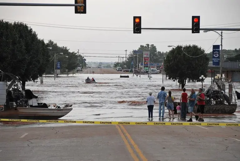
Stationary fronts can bring persistent cloudiness and precipitation. When storms repeatedly form and move along the same stalled boundary, a pattern called training, rain totals can pile up quickly.
What Is A Dryline?
A Dryline is a boundary between moist air and dry air, rather than warm and cold air. In the United States, it most often sets up across west Texas, western Oklahoma, Kansas and Nebraska in spring and early summer, separating:
- Maritime tropical air to the east, with dew points in the 60s F
- Continental tropical air to the west, from the desert Southwest, with dew points in the 20s and 30s F
Dew points can drop 20-40 F across just a few miles. Temperatures are often similar on both sides, or even warmer on the dry side during the afternoon.
The dryline has a distinctive daily rhythm. It often pushes east during the afternoon as daytime heating mixes the shallow moist layer with dry air above it, then retreats west overnight. Moist air is denser than dry air at the same temperature, so the dry air can override the moist air, and lift along the boundary helps trigger storms.
What Is An Outflow Boundary?
Thunderstorms create their own fronts. Rain-cooled air sinking out of a storm spreads along the ground as a pool of cold air, and its leading edge is an Outflow Boundary, also called a gust front.
Outflow boundaries:
- Behave like small cold fronts, with a wind shift, gusty winds and a temperature drop
- Can travel over 100 km from the storm that made them and last into the next day
- Show up on radar as thin lines of weak echoes, called fine lines
- Often trigger new storms where they collide with other boundaries
When a supercell moves along an old outflow boundary, the enhanced low-level wind shear and moisture along it can sharply raise the tornado threat.
Real-World Example: Boundaries On A Florida Summer Afternoon
On the Plains, chasers circle the dryline on spring afternoons, waiting for an isolated supercell to fire. Florida's version is the boundary collision. Sea breeze fronts and outflow boundaries from earlier storms crisscross the peninsula, and new storms erupt right where two of them meet.
You can see this on radar as thin arcs of weak echoes spreading away from storms. When one of those arcs heads for another boundary near you, expect new storms soon. Stalled fronts deserve respect too. When storms train over the same place, rain piles up fast. Turn Around, Don't Drown: just 12 inches of moving water can float a car.
Common Mistakes
- Myth: A dryline is a temperature boundary like a cold front. Fact: It separates moist air from dry air. Temperatures can be similar on both sides, and the dry side is often warmer in the afternoon.
- Myth: A stationary front means boring weather. Fact: Storms that repeatedly form and move along a stalled boundary can drop several inches of rain per hour and cause deadly flash flooding.
- Myth: Only big weather systems make fronts. Fact: Thunderstorms make their own. Outflow boundaries behave like small cold fronts and can trigger new storms over 100 km away.
Go Deeper: Why The Dryline Moves East By Day
The dryline's eastward afternoon surge is largely not advection of the boundary itself but vertical mixing. In the morning, a shallow moist layer from the Gulf lies beneath a deep, dry, well-mixed layer from the elevated terrain to the west. As daytime heating deepens the boundary layer, the moist layer on its western edge mixes out with the dry air above, so surface dew points crash and the dryline appears to jump east. After sunset, mixing stops, the boundary layer decouples, and low-level southeasterly flow brings moisture back west.
Because water vapor is lighter than dry air, moist air at the same temperature is less dense, and the dryline can carry a solenoidal circulation with rising motion on its moist side. Where that lift coincides with a bulge in the dryline or an intersecting boundary, initiation of isolated supercells is favored.
Check Yourself
No grades, no sign-in. Pick an answer and see how you did. The app keeps score for you and tracks your progress.
1 What forms an occluded front?
Show The Answer
A cold front overtakes a warm front The faster-moving cold front catches the warm front, lifting the warm sector air off the ground.
2 What separates the air masses along a dryline?
Show The Answer
A large moisture difference The dryline divides moist mT air from dry cT air, with dew points dropping sharply across it.
3 Why can stationary fronts cause flash flooding?
Show The Answer
Storms can repeatedly form and move over the same area Training storms along a stalled boundary can drop very heavy rain on the same location.
4 What is the triple point?
Show The Answer
Where the cold, warm and occluded fronts meet The triple point often has strong lift and shear and is a favored spot for severe storms.
5 What creates an outflow boundary?
Show The Answer
Rain-cooled air spreading out from a thunderstorm Cold air sinking from a storm spreads along the ground, and its leading edge is the outflow boundary.
Questions People Ask
What is a stationary front?
A boundary between air masses that is barely moving, usually because the winds on both sides blow roughly parallel to it.
What is the triple point in weather?
The spot where the cold, warm and occluded fronts meet. Strong lift and wind shear there often support severe storms, including tornadic supercells.
Where does the dryline usually form?
Across west Texas, western Oklahoma, Kansas and Nebraska in spring and early summer, between moist Gulf air and dry desert air.
What does an outflow boundary look like on radar?
A thin, often arc-shaped line of weak echoes spreading away from storms, called a fine line.
What are the two types of occluded fronts?
A cold occlusion, where the air behind the cold front is colder and slides underneath, and a warm occlusion, where it rides up over colder air ahead of the warm front.
Learn More From The Experts
- Norwegian Cyclone Model NOAA / NWS JetStream
- How To Read Surface Weather Maps NOAA / NWS JetStream
Fronts get the headlines, but the boundaries are where the action starts. Keep one eye on the radar fine lines. — Jen
