
What Is A GOES Satellite?
GOES satellites are NOAA's Geostationary Operational Environmental Satellites. They orbit about 22,236 miles above the equator, matching Earth's spin, so each stays over one spot. GOES-East and GOES-West image the Americas as often as every minute and carry the Geostationary Lightning Mapper, which detects lightning day and night over land and ocean.
The lightning layer in LightningWX comes from a camera parked about 22,236 miles over the equator. I still find that a little wild. This lesson covers how GOES hangs in one spot, what it sees, and how it counts lightning flashes from that far away.
Key Takeaways
- Geostationary satellites orbit about 35,786 km (22,236 miles) up and appear fixed over one spot on the equator.
- GOES-East and GOES-West cover the Americas and the Atlantic and Pacific; satellites rotate through those slots.
- The Advanced Baseline Imager has 16 bands and can scan mesoscale sectors every minute.
- The Geostationary Lightning Mapper detects total lightning, in-cloud and cloud-to-ground, day and night.
- Polar orbiters fly lower, see finer detail and supply soundings that feed global models.
Nearly every satellite image you see on American weather broadcasts comes from the GOES series, the Geostationary Operational Environmental Satellites operated by NOAA. This lesson covers how these satellites stay in place, what instruments they carry, how they map lightning from 35,000 km away, and how they work alongside polar-orbiting satellites.
How Do Geostationary Satellites Stay In One Place?
A Geostationary Satellite orbits directly over the equator at an altitude of about 35,786 km (22,236 miles). At that height, one orbit takes exactly as long as one rotation of Earth, about 23 hours 56 minutes. The satellite travels eastward with the planet's spin, so from the ground it appears to hang motionless in the sky.
That fixed viewpoint is the whole point:
- The satellite watches the same area continuously, so images can be looped into smooth animations.
- Rapid updates catch storms forming, growing and decaying.
- One satellite sees roughly a third of Earth's surface.
The tradeoff is distance. From so far away, resolution is coarser than a low-orbit satellite can achieve, and views of high latitudes are badly foreshortened. Poleward of about 60 to 65 degrees latitude, geostationary imagery becomes stretched and unreliable.
What Is The Difference Between GOES-East And GOES-West?
NOAA keeps two operational satellites in position, plus spares in orbit:
- GOES-East, stationed near 75.2 degrees West, covers the eastern United States, the Atlantic hurricane basin, and South America.
- GOES-West, near 137.2 degrees West, covers the western United States, Alaska, Hawaii and much of the Pacific.
The current generation, the GOES-R series (GOES-16, 17, 18 and 19), began launching in 2016 and brought a dramatic leap in capability. Specific satellites rotate through the East and West slots as newer ones replace older ones, so the operational names are more stable than the numbers.
The Advanced Baseline Imager
The main instrument is the Advanced Baseline Imager (ABI), which scans Earth in 16 spectral bands:
- 2 visible bands (blue at 0.47 and red at 0.64 micrometers). The red band has the finest resolution, 0.5 km.
- 4 near-infrared bands, useful for vegetation, snow versus cloud, cloud particle size, and fire detection.
- 10 infrared bands, including three water vapor bands (6.2, 6.9 and 7.3 micrometers), the "clean" longwave window at 10.3 micrometers, and bands sensitive to ozone, sulfur dioxide and low-level moisture.
By combining bands, forecasters build products such as true-color imagery, fog detection, fire hot spots, dust and volcanic ash tracking, and cloud-top phase.
Scan Modes And Mesoscale Sectors
In its standard mode the ABI produces:
- A full disk image of the whole visible hemisphere every 10 minutes.
- A CONUS (contiguous U.S.) or PACUS sector every 5 minutes.
- Two **mesoscale sectors, each about 1,000 km by 1,000 km, every 1 minute**.
Forecasters request mesoscale sectors over expected severe weather, hurricanes or wildfires. When the two sectors overlap on the same spot, imagery updates every 30 seconds. One-minute imagery lets you watch individual updrafts surge, overshooting tops pulse, and outflow boundaries race away from storms.
How Do Satellites Detect Lightning?
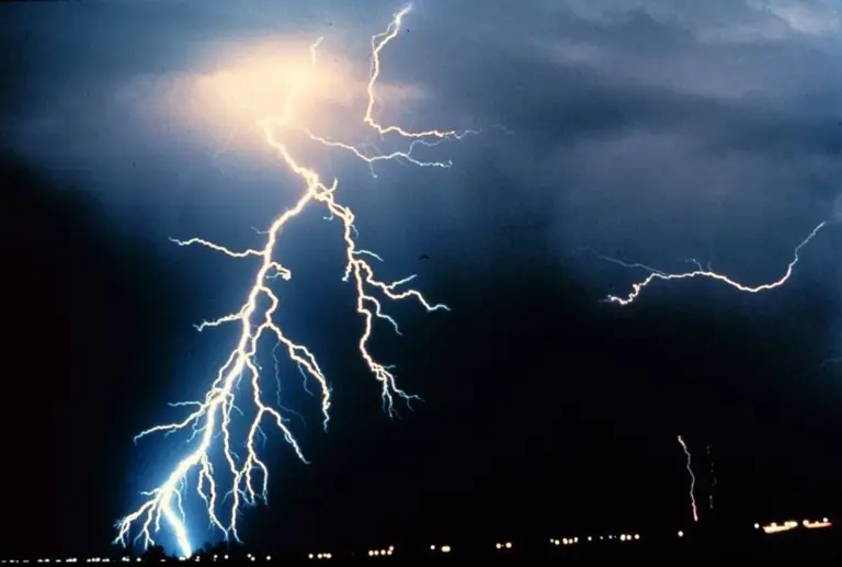
Each GOES-R satellite also carries the Geostationary Lightning Mapper (GLM), the first operational lightning sensor in geostationary orbit. It is a high-speed camera that stares at the Western Hemisphere and takes about 500 images per second in a narrow near-infrared band at 777.4 nanometers, a wavelength where oxygen atoms in a lightning channel glow brightly.
Key facts about GLM:
- It detects total lightning, both cloud-to-ground and in-cloud flashes. Most ground networks are best at cloud-to-ground strokes.
- It sees the light scattering out of the cloud top, day and night, over land and ocean.
- It measures flash rate, flash extent (how far a flash spreads), and optical energy.
Why does this matter? A sudden, sharp increase in total Lightning rate, a lightning jump, often precedes severe hail, damaging winds or tornadoes by 10 to 30 minutes, because it reflects a rapidly intensifying updraft. GLM also reveals "megaflashes," horizontal discharges that can stretch hundreds of kilometers across large storm systems, and fills radar gaps over the oceans.
What Is The Difference Between Geostationary And Polar Satellites?
A Polar-Orbiting Satellite flies much lower, about 830 km (515 miles) up, crossing near both poles on each orbit of roughly 100 minutes. Earth rotates beneath it, so it sees a new strip each pass and covers the entire globe about twice a day.
NOAA's polar program is the Joint Polar Satellite System (JPSS), including Suomi NPP and NOAA-20 and NOAA-21. Their instruments include the VIIRS imager (with a Day/Night Band that can see city lights and moonlit clouds) and sounders that measure temperature and humidity profiles through the atmosphere.
Polar orbiters provide:
- Higher resolution than geostationary imagery.
- Good coverage of the polar regions.
- Vertical temperature and moisture soundings that are among the most important inputs to global forecast models.
Geostationary satellites excel at frequent monitoring; polar orbiters excel at detail and global soundings. Together they form the backbone of the global observing system.
Real-World Example: Lightning Over The Open Gulf And Atlantic
Ground radar reaches only so far offshore. During hurricane season, storms over the open Atlantic or Gulf can be far beyond any coastal radar, yet GLM keeps mapping their lightning, day and night, along with the rest of the Western Hemisphere it stares at.
NOAA notes that changes in lightning activity can signal an intensifying storm and can reveal structural changes in hurricanes. On land, a sudden lightning jump in a thunderstorm often comes 10 to 30 minutes before severe weather, because it reflects an updraft that is rapidly strengthening. It is a clue for forecasters, not a warning for you. Warnings come from the NWS.
Common Mistakes
- Myth: Geostationary satellites sit still in space. Fact: They move fast, completing one orbit every 23 hours 56 minutes, which matches Earth's rotation. They only look still from the ground.
- Myth: Satellite lightning only counts strikes that hit the ground. Fact: GLM detects total lightning, both in-cloud and cloud-to-ground. Most ground networks are best at cloud-to-ground strokes.
- Myth: A satellite image shows exactly what is happening right now. Fact: Images take a few minutes to process and distribute, so you are always looking at the very recent past.
- Myth: If I can't see lightning nearby on the map, I'm safe outside. Fact: Lightning can strike 10 miles or more from its storm. If you hear thunder, go indoors, whatever any map shows.
Go Deeper: How GLM Picks Flashes Out Of A Sunlit Cloud
GLM is a staring optical imager with a very narrow filter centered on 777.4 nanometers, a near-infrared emission line of neutral atomic oxygen that glows strongly in a lightning channel. Sunlight reflected off cloud tops is also bright at that wavelength, so the instrument takes about 500 frames per second and compares each frame to a running background. Light that jumps above the background for a moment is flagged as an event.
Ground processing clusters adjacent events in the same frame into groups, and groups close in space and time into flashes. Because GLM sees light scattered out the top of the cloud rather than the channel itself, it measures flash location, extent and optical energy instead of the electrical current. That is why it complements, rather than replaces, ground-based networks that pinpoint return strokes.
Check Yourself
No grades, no sign-in. Pick an answer and see how you did. The app keeps score for you and tracks your progress.
1 At about what altitude do geostationary satellites orbit?
Show The Answer
35,786 km (22,236 miles) At about 35,786 km, one orbit matches Earth's rotation, so the satellite stays over one spot on the equator.
2 How many spectral bands does the Advanced Baseline Imager have?
Show The Answer
16 The ABI has 16 bands: 2 visible, 4 near-infrared and 10 infrared.
3 How often do GOES mesoscale sectors update?
Show The Answer
Every minute Each mesoscale sector updates every 60 seconds, and overlapping sectors can deliver 30-second imagery.
4 What makes the Geostationary Lightning Mapper especially valuable?
Show The Answer
It detects total lightning, including in-cloud flashes, across land and ocean GLM detects both in-cloud and cloud-to-ground lightning day and night, and sudden lightning jumps can warn of intensifying storms.
5 What is a main advantage of polar-orbiting satellites like JPSS?
Show The Answer
They give higher-resolution views and global soundings, including the poles Flying much lower and crossing the poles, polar orbiters see finer detail and provide soundings that feed global models.
Questions People Ask
How high are GOES weather satellites?
About 35,786 km, or 22,236 miles, above the equator. At that height one orbit matches Earth's rotation.
How often do GOES satellite images update?
In standard mode, a full disk every 10 minutes, the continental U.S. every 5 minutes, and two mesoscale sectors every minute. Overlapping sectors can give 30-second imagery.
Can satellites see lightning during the day?
Yes. GLM uses a narrow near-infrared filter and very fast imaging to pick out lightning flashes against sunlit clouds, day and night.
Which GOES satellite covers Florida?
GOES-East, stationed near 75.2 degrees West, covers the eastern United States and the Atlantic hurricane basin, including Florida.
What do polar-orbiting weather satellites do?
They fly about 830 km up, cover the whole globe about twice a day, give higher-resolution imagery, and provide temperature and moisture soundings for global forecast models.
Learn More From The Experts
- Geostationary Satellites (GOES-R Series) NOAA NESDIS
- Geostationary Lightning Mapper (GLM) NOAA NESDIS
A camera 22,236 miles up, counting flashes 500 times a second. And still, when thunder roars, you go indoors. Jen — Jen
