Simulation Mode
Create and explore synthetic teaching scenarios. Pause the life cycle, change a parameter and inspect the result. Included in the desktop trial and license.
03 / REPLAY / Pause. Compare. Understand.
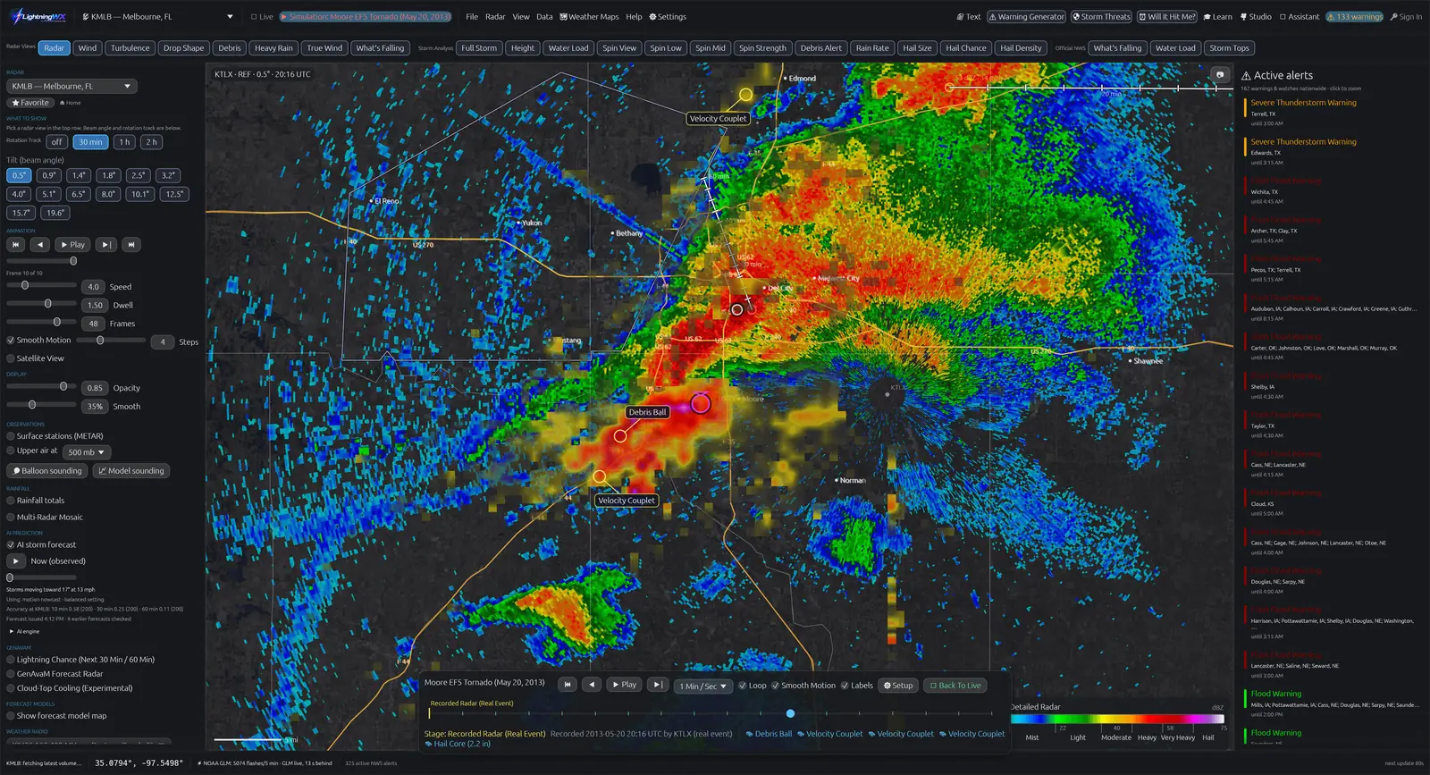
Tornado simulation software lets you pause and explore a controlled storm scenario. Historical radar replay lets you examine radar observations from a real past event. LightningWX includes Simulation Mode, a curated Case Library and a license-only Past Storms archive browser, plus public 3D Storm Scene and Volume Explorer.
Use the schematic timeline below to learn the workflow, then open the app to work with actual radar. Everything on this page is a teaching illustration or a historical capture, never a current warning or forecast.
An original conceptual illustration, not observed radar, a numerical tornado forecast or a reconstruction of a named event. Real storms do not follow a fixed sequence.
Stage 1 of 5: Growing Cell. Compare the developing echo with the next stage.
Create and explore synthetic teaching scenarios. Pause the life cycle, change a parameter and inspect the result. Included in the desktop trial and license.
Study selected real-event cases with the app’s teaching controls. Curated case access is included in the trial and license; it is distinct from unrestricted archive browsing.
Choose historical radar observations by date and radar site. Past Storms requires a license and is excluded from the five-day trial. Availability varies by site, time and archive.
NOAA’s NEXRAD archive preserves Level II and Level III radar observations. A replay displays what the radar sampled, including its coverage and timing limitations. A synthetic storm produces teaching data. Neither mode reports current weather.
Moore / May 20, 2013 / KTLX: compare the hook, velocity couplet and dual-pol context across successive archived scans. Check each scan’s UTC timestamp in the app.
This selector changes the study guide. It does not download or play archived radar. Open LightningWX’s Case Library or licensed Past Storms browser to inspect the actual data.
A tornado’s EF rating comes from a damage assessment, not from the color or shape of a radar echo. Use the tornado lessons and radar science course to connect each image to the underlying limits.
Yes. LightningWX includes curated real-event cases, while the separate Past Storms archive browser requires a license. Available observations and products depend on the event date, radar site and archive coverage.
No. It is an explicitly labeled synthetic teaching illustration. Actual LightningWX screenshots are labeled separately; use the app to inspect observed archived scans.
Simulation Mode and curated Case Library access are included in the five-day desktop trial. Past Storms archive browsing, NWS Spotter Reports, screenshots and recording are excluded.
No. EF ratings are based on damage assessment. Radar signatures support analysis but do not independently determine a surface damage rating.
Launch promotion: $119 one time, through April 4, 2027. Yours forever, with no subscription or renewal. Use your account on up to three desktop PCs. Basic Radar is free forever.
The free five-day desktop trial requires a free account and excludes screenshots, screen recording, Past Storms and NWS Spotter Reports. Those features are included with the license. Eligible license holders can also access the web workstation; browser support and features vary.
Continue with the NWS Radar FAQ, official SKYWARN program, NOAA NEXRAD archive and NWS lightning safety guidance.
By Jen / GenM Software. Reviewed November 11, 2026. LightningWX is an independent learning and weather-awareness tool.

lightningwx.com uses its own analytics to understand how the site is used. With your OK, it also records clicks and scrolling so I can improve these pages. The homepage also uses Meta Pixel, which sends page visits and browser/device information to Meta (Facebook) for advertising measurement. Accept and Decline below control click-and-scroll recording, not Meta Pixel. Privacy Policy